Relationships between ENSO and Daily
Precipitation in the United States
In this section we examine seasonal relationships between warm and cold ENSO episodes and United States daily precipitation statistics. These results provide the necessary background for an investigation of decade-scale changes in daily precipitation statistics in section 5. All results are based on the classification of warm and cold episodes described in section 2. Wet days are defined as those on which measurable precipitation occurred (precipitation greater than or equal to 1.0 mm day-1). The sum of wet and dry days equals the total number of days in the season.
a. Wet / dry days
i. Spatial maps
The mean (1948-1996) number of wet (dry) days for JFM, AMJ, JAS, OND and annual are shown in Figs. 1-5. The number of wet days per season is highest in the PNW during JFM and lowest in the southwest JAS. Measurable precipitation along the west coast of Washington and Oregon is observed on more than 50% of the days during JFM while measurable precipitation over portions of the Southwest is observed less than 10% of the time during JAS. The mean number of wet days and the anomalous number of wet days (departures from mean (1948-1996) values) for moderate strong El Nino, moderate/strong La Nina and neutral episodes (based on JFM 1948-1996) are shown for each season and on an annual basis in Figs. 6-10. The anomaly patterns are very familiar and dominate operational forecasts of ENSO effects on United States precipitation, especially in the autumn, winter and spring. Throughout the annual cycle there is no discernable effect of tropical Pacific SST's on United States precipitation during neutral winters.
In Figs. 11-15 we explore the average number of wet days per season that occur for daily precipitation events exceeding 0.5 inch (1.0 inch). Examination of the results for daily events exceeding 0.5 inch indicates that the largest number of heavy precipitation events occurs in the PNW, the northern half of California and in the Gulf Coast States during JFM. Examination of the mean and anomalous number of wet days during the winter (JFM) which exceed 0.5 inch for moderate strong El Nino episodes, moderate/strong La Nina episodes and neutral episodes (Fig. 16) illustrates the well known relationship between ENSO and heavy precipitation events along the west coast (i.e. the precipitation dipole between the PNW and Central/Southern California); the antisymmetric nature of this dipole is also clearly evident when the anomalous number of wet days for El Nino and La Nina are compared. The figures also show a coherent out of phase relationship in the Tennessee Valley and the southeastern Gulf Coast States during the autumn (Fig. 19), winter (Fig. 16) and spring (Fig. 17). Again we find that there is no discernable effect during the neutral winters. The basic patterns remain in tact for precipitation events exceeding 1.0 inch, though the amplitude of the signal in the Tennessee Valley has diminished somewhat during the cold season. Similar patterns are obtained during each season when we examine the mean and anomalous number of wet days that exceed 1.0 inch during moderate strong El Nino episodes, moderate/strong La Nina episodes and neutral episodes (Figs. 21-25).
It also useful to know the average number of days between rain events (Fig. 26). During the winter season the longest stretches of rainless days are typically along the front range of the Rocky Mountains. During the summer season the longest stretches of rainless days are typically in the southwestern United States. The mean and anomalous number of days between rain events for moderate/strong El Nino, moderate strong La Nina and neutral episodes (Figs. 27-31) show a very strong sensitivity during the winter in the southwest, particularly for La Nina events. In particular, the average number of days between rain events increases by more than 50% during La Nina episodes over large portions of the southwest United States Alternately, during El Nino the average number of days between rain events decreases on the order of 25-50%.
ii. Individual sites
The following histograms are included in the electronic version of the ATLAS for selected major cities in the conterminous United States:
(I) Frequency distribution of daily precipitation (i.e. daily precipitation amount versus percentage of total days). The sum of frequency values equals the fraction of total days (wet plus dry days) that are wet (precipitation exceeding 1 mm day-1).
(II) Frequency distribution of daily precipitation (i.e. daily precipitation amount versus percentage of total days) for moderate / strong El Nino episodes, moderate / strong La Nina episodes and neutral episodes. The sum of frequency values equals the fraction of total days that are wet (precipitation exceeding 1 mm day-1).
(III) Histograms of the number of heavy daily precipitation events (events at or above the 90th percentile) during moderate / strong El Nino episodes, moderate / strong La Nina episodes and neutral episodes.
The selected sites are:
Atlanta, Georgia Miami, Florida
Boston, Massachusetts New Orleans, Louisiana
Chicago, Illinois New York, New York
Dallas, Texas Philadelphia, Pennsylvania
Denver, Colorado Phoenix, Arizona
Detroit, Michigan San Francisco, California
Kansas City, Missouri Seattle, Washington
Los Angeles, California Washington, DC
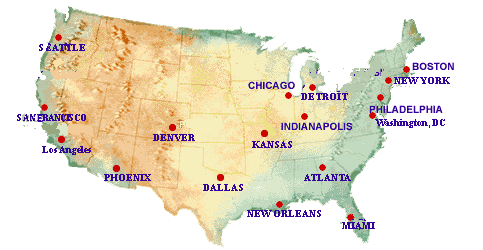
The results are based on gridded data, which implies that the selected sites are the gridpoints nearest the cities above. In each case the statistics are based on daily precipitation for 1948-1996 and are shown by season (i.e. JFM, AMJ, JAS, OND and annual). Figs. 32-34 show a sample of (I)-(III) above for the Seattle region during JFM.
b. Total precipitation
i. Spatial patterns
The mean total precipitation for JFM, AMJ, JAS, OND and the annual mean are shown on Fig. 35. The mean total precipitation is heaviest in the PNW during OND and JFM and lightest in the Southwest during AMJ and JAS. The mean total and anomalous precipitation for moderate / strong El Nino episodes, moderate/strong La Nina episodes and neutral episodes are shown for each season and for the entire year in Figs. 36-40. Shading on the anomaly maps indicates where anomalies exceed 25% (50%) of the mean. As expected the anomaly patterns are familiar and dominate operational forecasts of ENSO effects on United States precipitation.
ii. Individual sites
The following histograms are included in the electronic version of the ATLAS for selected major cities in the conterminous United States:
(I) Contribution of daily precipitation to the total seasonal precipitation (i.e. daily precipitation amount versus percentage of total precipitation).
(II) Contribution of daily precipitation to the total seasonal precipitation (i.e. daily precipitation amount versus percentage of total precipitation) for moderate / strong El Nino episodes, moderate / strong La Nina episodes and neutral episodes.
The selected sites are:
Atlanta, Georgia Miami, Florida
Boston, Massachusetts New Orleans, Louisiana
Chicago, Illinois New York, New York
Dallas, Texas Philadelphia, Pennsylvania
Denver, Colorado Phoenix, Arizona
Detroit, Michigan San Francisco, California
Kansas City, Missouri Seattle, Washington
Los Angeles, California Washington, DC
The results are based on gridded data, which implies that the selected sites are the gridpoints nearest the cities above. In each case the statistics are based on daily precipitation for 1948-1996 and are shown by season (i.e. JFM, AMJ, JAS, OND and annual). Figs. 41-42 show a sample of (I)-(II) above for the Seattle region during JFM.
c. Ratio of frequencies
The frequency of daily precipitation amounts at least equal to the 90th percentile was computed for each season (JFM, AMJ, JAS, OND) and on an annual basis using data for 1948-1996. Results for each season and for the entire year are presented as the ratio of the frequency for El Nino years to the frequency for La Nina years, as the ratio of the frequency for El Nino years to the frequency for neutral years, and as the ratio of the frequency for La Nina years to the frequency for neutral years (Figs. 43-47). The pattern that emerges in Fig. 43 (top) is similar to that described in previous studies (e.g. Redmond and Koch 1991) of the influence of ENSO upon the seasonal mean precipitation. Relative to La Nina winters, El Nino winters favor more frequent daily extreme events in the Southwest and less frequent extreme events in the Northwest. In the Southwest, the ENSO precipitation frequency signal has a higher amplitude than in the Northwest. Near the strongest core areas, extreme events in the Southwest during El Nino winters are 5 times more likely than during La Nina winters and are about 50% as likely in the Northwest.
The middle and bottom panels on Fig. 43 are an attempt to separate El Nino and La Nina frequencies of extreme precipitation events. To first approximation, there are symmetric opposite patterns of hydrologic extremes (particularly over the western US) for the warm and cold phases of ENSO. However, Hoerling et al. (1997) have shown that nonlinearities exist so the two phases of ENSO do not produce symmetric circulations and attendant surface anomaly patterns.